|
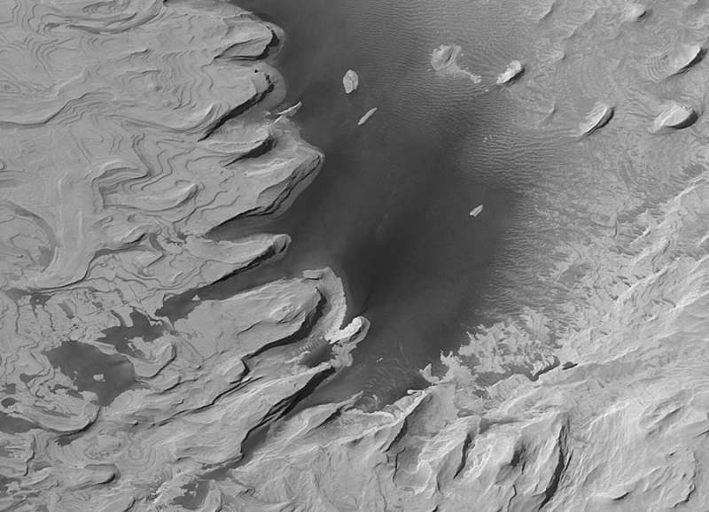
Explanation: Is this a picture of Mars or Earth? Oddly enough, it is a picture of Mars. What may appear to some as a terrestrial coastline is in fact a formation of ancient layered hills and wind-blown sand on Mars. The above-pictured region spans about three kilometers in Schiaparelli Crater. What created the layers of sediment is still a topic of research. Viable hypotheses include ancient epochs of deposit either from running water or wind-blown sand. Winds and sandstorms have smoothed and eroded the structures more recently. The "water" that appears near the bottom is actually dark colored sand. The image was taken with the Mars Global Surveyor spacecraft that operated around Mars from 1996-2006 and returned over 200,000 images.
|
January February March April May June July August September October November December |
| |||||||||||||||||||||||||||||||||||||||||||||||||||||||
NASA Web Site Statements, Warnings, and Disclaimers
NASA Official: Jay Norris. Specific rights apply.
A service of: LHEA at NASA / GSFC
& Michigan Tech. U.
Based on Astronomy Picture
Of the Day
Publications with keywords: Mars
Publications with words: Mars
See also:
- APOD: 2026 February 1 Á Galle: Happy Face Crater on Mars
- APOD: 2025 September 28 Á Leopard Spots on Martian Rocks
- APOD: 2025 July 15 Á Collapse in Hebes Chasma on Mars
- APOD: 2025 July 6 Á The Spiral North Pole of Mars
- APOD: 2025 June 29 Á Dark Sand Cascades on Mars
- APOD: 2025 June 22 Á A Berry Bowl of Martian Spherules
- APOD: 2025 June 15 Á Two Worlds One Sun
