|
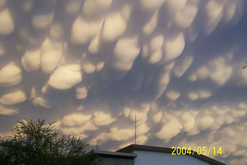
Credit & Copyright: Raymundo Aguirre
Explanation:
Normal cloud bottoms are flat because moist warm air
that rises and cools will
condense into water droplets at a very specific temperature,
which usually corresponds to a very specific height.
After water
droplets form that air becomes an opaque cloud.
Under some conditions, however,
cloud pockets can develop that contain large droplets
of water or ice that fall into clear air as they evaporate.
Such pockets may occur in
turbulent air near a
thunderstorm, being seen near the top of an
anvil cloud, for example.
Resulting mammatus clouds can appear especially dramatic if sunlit from the side.
These
mammatus clouds
were photographed over
Monclova,
Mexico.
APOD presents: Astronomy Pictures of the Year for 2007
|
January February March April May June July August September October November December |
| |||||||||||||||||||||||||||||||||||||||||||||||||||||||
NASA Web Site Statements, Warnings, and Disclaimers
NASA Official: Jay Norris. Specific rights apply.
A service of: LHEA at NASA / GSFC
& Michigan Tech. U.
Based on Astronomy Picture
Of the Day
Publications with keywords: Mammatus clouds - Mexico - clouds
Publications with words: Mammatus clouds - Mexico - clouds
See also:
- APOD: 2026 January 6 Á Jupiters Clouds in High Definition from Juno
- APOD: 2025 August 17 Á Asperitas Clouds Over New Zealand
- Nacreous Clouds over Sweden
- APOD: 2024 November 19 Á Undulatus Clouds over Las Campanas Observatory
- APOD: 2024 July 7 Á Iridescent Clouds over Sweden
- APOD: 2023 August 20 Á A Roll Cloud Over Wisconsin
- APOD: 2023 February 12 Á Mammatus Clouds over Nebraska
