|
Credit & Copyright: Michael Fulbright
(MSFAstro.net)
Explanation:
Most star clusters are singularly impressive.
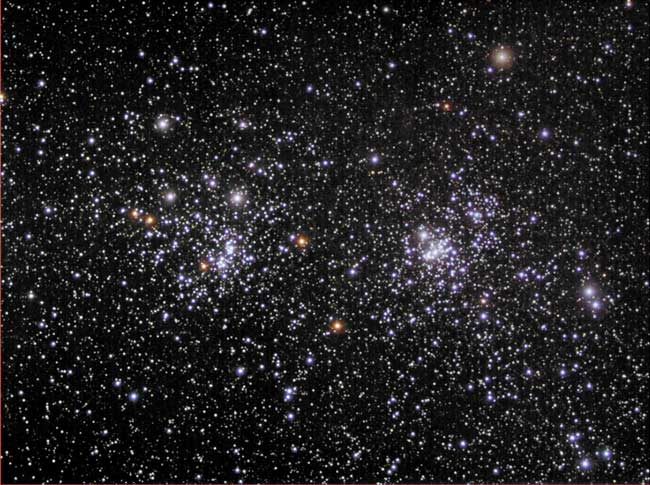
Open clusters NGC 869 and NGC 884,
however, are doubly impressive.
Also known as "h and chi Persei", this unusual
double cluster, shown above, is bright enough to be seen from a
dark location without even binoculars.
Although their discovery surely predates
written history, the Greek astronomer
Hipparchus notably cataloged the "double
cluster".
The clusters are over 7000 light years distant toward the
constellation of
Perseus, but are separated by only hundreds of light years.
|
January February March April May June July August September October November December |
| ||||||||||||||||||||||||||||||||||||||||||||||||
NASA Web Site Statements, Warnings, and Disclaimers
NASA Official: Jay Norris. Specific rights apply.
A service of: LHEA at NASA / GSFC
& Michigan Tech. U.
Based on Astronomy Picture
Of the Day
Publications with keywords: open cluster
Publications with words: open cluster
See also:
- APOD: 2026 April 13 Á NGC 602 and Beyond
- APOD: 2025 August 7 Á The Double Cluster in Perseus
- APOD: 2025 April 28 Á Gum 37 and the Southern Tadpoles
- Open Star Clusters M35 and NGC 2158
- APOD: 2025 February 25 Á M41: The Little Beehive Star Cluster
- APOD: 2025 February 11 Á The Spider and the Fly
- APOD: 2024 October 29 Á NGC 602: Stars Versus Pillars from Webb
