Credit & Copyright: R. White (STScI) and the
PS1 Science Consortium
Explanation:
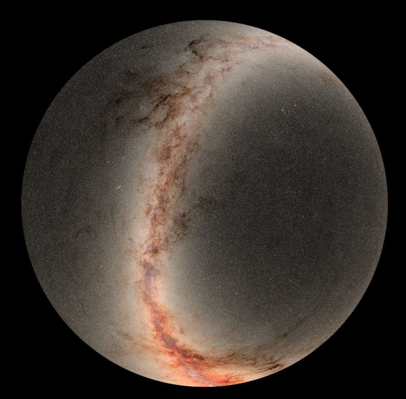
This astronomical sky
spanning view is a mosaic from the Pan-STARRS observatory.
The images were recorded with its 1.8 meter telescope at the summit of
Haleakala on planet Earth's island of Maui.
In fact, Earth's north celestial pole is centered in this across-the-sky
projection.
A declination
of -30 degrees, the southern horizon limit as seen from the
Hawaiian Valley Isle, defines the circular outer edge.
Crowded starfields
and cosmic dust clouds along the plane of our Milky
Way galaxy stretch across the scene with the bright
bulge of the galactic center at the bottom.
Compiled over four years, the image data represent
the second edition of data from Pan-STARRS
(Panoramic Survey Telescope & Rapid Response System), currently
the planet's
largest digital sky survey.
In 2017 Pan-STARRS was used to first recognize the interstellar voyage of
'Oumuamua, visitor to our Solar System.
1999 2000 2001 2002 2003 2004 2005 2006 2007 2008 2009 2010 2011 2012 2013 2014 2015 2016 2017 2018 2019 2020 2021 2022 2023 2024 2025 2026 |
Январь Февраль Март Апрель Май Июнь Июль Август Сентябрь Октябрь Ноябрь Декабрь |
NASA Web Site Statements, Warnings, and Disclaimers
NASA Official: Jay Norris. Specific rights apply.
A service of: LHEA at NASA / GSFC
& Michigan Tech. U.
|
Публикации с ключевыми словами:
sky map - небо
Публикации со словами: sky map - небо | |
См. также:
Все публикации на ту же тему >> | |
