
|
You entered: terrain
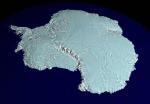 A RADARSAT Map of Antarctica
15.11.1999
It's not easy to make a map of Antarctica. Earth's southern most continent is so cold and inhospitable that much of it remains unexplored. From space, though, it is possible to map this entire region by radar: by systematically noting how long it takes for radio waves to reflect off the terrain.
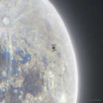 Space Station Silhouette on the Moon
5.12.2021
What's that unusual spot on the Moon? It's the International Space Station. Using precise timing, the Earth-orbiting space platform was photographed in front of a partially lit gibbous Moon last month.
 Saturns Moon Helene from Cassini
9.03.2010
What's happening on the surface of Saturn's moon Helene? The moon was imaged in unprecedented detail last week as the robotic Cassini spacecraft orbiting Saturn swooped to within two Earth diameters of the diminutive moon.
 Stereo Pluto
5.08.2015
These two detailed, true color images of Pluto were captured during the historic New Horizons flyby last month. With slightly different perspectives on the now recognizeable surface features they are presented in this first high quality stereo pair intended for viewing by denizens of planet Earth.
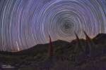 Star Trails and Tajinastes
18.06.2010
What bizarre planet do these alien creatures inhabit? It's only planet Earth, of course. In this well-composed scene, the sky is filled with star trails around the north celestial pole. A reflection...
 50 Miles on Pluto
15.07.2015
A 50 mile (80 kilometer) trip across Pluto would cover the distance indicated by the scale bar in this startling image. The close-up of the icy world's rugged equatorial terrain was captured when the New Horizons spacecraft was about 47,800 miles (77,000 kilometers) from the surface, 1.5 hours before its closest approach.
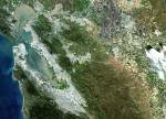 Landsat 7 Views Planet Earth
14.05.1999
Launched last month, NASA's Landsat 7 spacecraft now orbits planet Earth. Looking down from an altitude of 700 km, Landsat 7 can map the planet's surface in visible and infrared bands and resolve features 30 meters across or smaller.
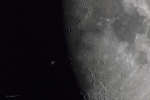 Space Station over Lunar Terminator
26.04.2015
What's that in front of the Moon? It's the International Space Station. Using precise timing, the Earth-orbiting space platform was photographed in front of a partially lit Moon last year. The featured image was taken from Madrid, Spain with an exposure time of only 1/1000 of a second.
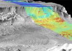 Night and Day in Melas Chasma on Mars
15.12.2002
What types of terrain are found on Mars? Part of the answer comes from thermal imaging by the robot spacecraft 2001 Mars Odyssey currently orbiting Mars. The above picture is a superposition of two infrared images, a black and white image taken during Martian daylight and a false-color image taken at night.
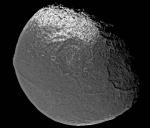 Saturns Iapetus: Moon with a Strange Surface
31.01.2005
What has happened to Saturn's moon Iapetus? A strange ridge crosses the moon near the equator, visible near the bottom of the above image, making Iapetus appear similar to the pit of a peach. Half of Iapetus is so dark that it can nearly disappear when viewed from Earth.
|
January February |
|||||||||||||||||||||||||||||||||||||||||||||||||