 |
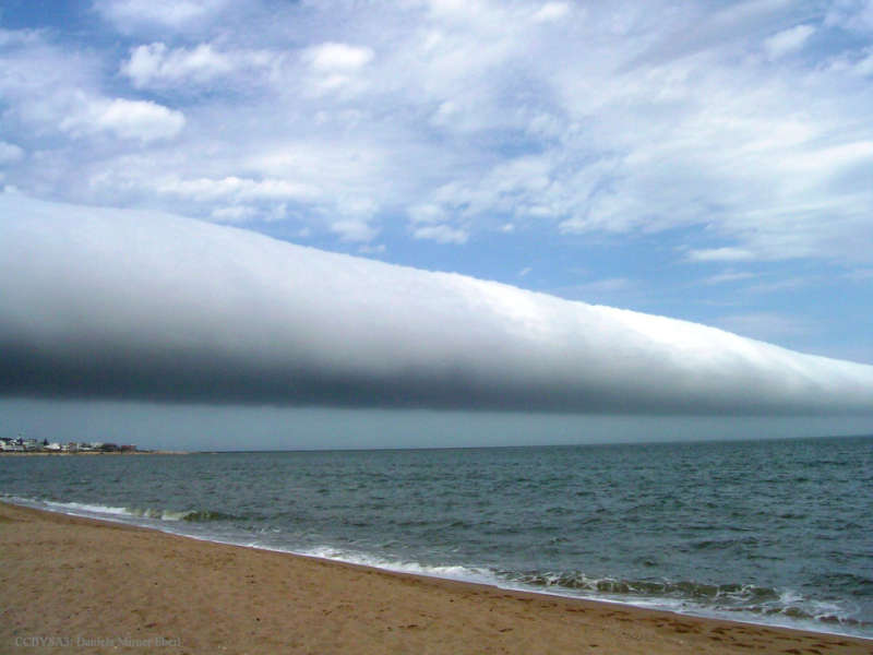
Астронет: Астрономическая картинка дня Грозовой воротник над Уругваем http://www.astronet.ru/db/msg/1364123/eng |
Credit & Copyright: Daniela Mirner Eberl
Explanation:
What kind of cloud is this?
A type of
arcus cloud called a
roll
cloud.
These rare long clouds may form near advancing cold fronts.
In particular, a downdraft from an advancing storm front can cause moist warm air
to rise, cool
below its
dew point, and so form
a cloud.
When this happens uniformly along an extended front, a
roll cloud may form.
Roll clouds
may actually have air circulating along the
long horizontal axis of the cloud.
A roll cloud is not thought to be able to morph into a
tornado.
Unlike a similar
shelf cloud,
a roll cloud is completely detached from their parent
cumulonimbus cloud.
Pictured
above, a
roll cloud extends far into the distance in 2009 January
above Las Olas Beach in
Maldonado,
Uruguay.
Authors & editors:
Robert Nemiroff
(MTU) &
Jerry Bonnell
(USRA)
NASA Web Site Statements, Warnings,
and Disclaimers
NASA Official: Jay Norris.
Specific
rights apply.
A service of:
LHEA at
NASA /
GSFC
& Michigan Tech. U.
