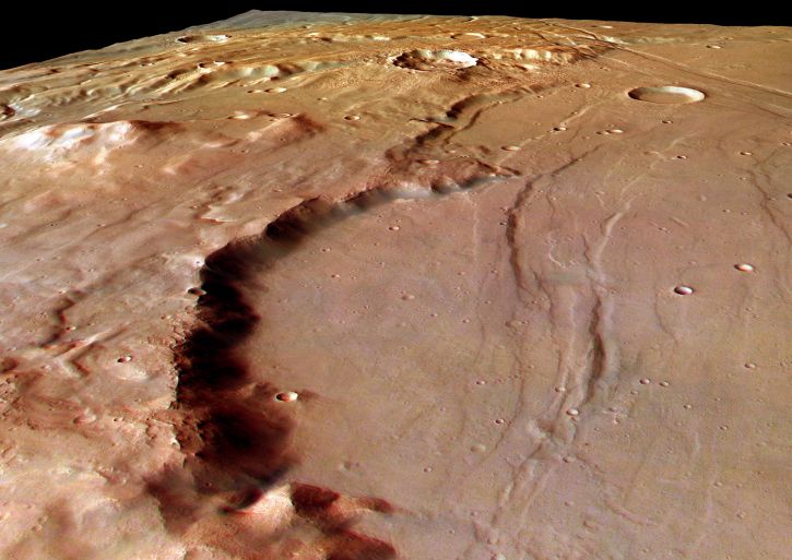
Explanation: This dramatic perspective view looks south-east along the wall of a large eroded impact crater on Solis Planum, bordering the mountainous Thaumasia region of Mars. Stretching for about 50 kilometers into the scene, the crater wall is around 800 meters high. Located just south and west of the Red Planet's grand Valles Marineris, this area features mountains and fault lines that are seen as evidence of surface plate motions or plate tectonics. The process of plate tectonics has long been shaping the surface of planet Earth but is thought to have been only briefly active on Mars. The image was constructed using color image data from the High Resolution Stereo Camera onboard ESA's Mars Express spacecraft.
1999 2000 2001 2002 2003 2004 2005 2006 2007 2008 2009 2010 2011 2012 2013 2014 2015 2016 2017 2018 2019 2020 2021 2022 2023 2024 2025 2026 |
Январь Февраль Март Апрель Май Июнь Июль Август Сентябрь Октябрь Ноябрь Декабрь |
NASA Web Site Statements, Warnings, and Disclaimers
NASA Official: Jay Norris. Specific rights apply.
A service of: LHEA at NASA / GSFC
& Michigan Tech. U.
|
Публикации с ключевыми словами:
planum - crater - Mars - плато - кратер - Марс
Публикации со словами: planum - crater - Mars - плато - кратер - Марс | |
См. также:
Все публикации на ту же тему >> | |
