|
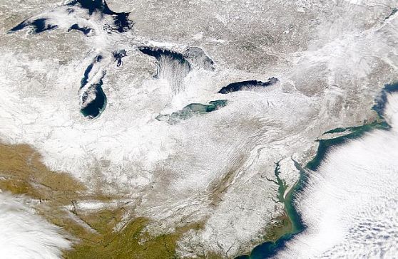
Explanation: Earth is an ocean planet. From low Earth orbit, the Sea-viewing Wide Field-of-view Sensor (SeaWiFS) instrument onboard NASA's SeaStar spacecraft globally maps ocean color, tracking changes in the climate and biosphere of our water world. Richly detailed SeaWiFS images can also follow color changes in Earth's landmasses as illustrated in this close-up picture of the planet. Taken on January 27, it covers the Great Lakes region and Atlantic coastal areas of the North American continent. The space-based perspective splendidly reveals the extent of fractal white seasonal solid phase H20 recently sprinkled over the Northeastern and Midatlantic US. Unanticipated and intense, the snowstorm delighted school children but caused serious disruptions in many locales.
|
January February March April May June July August September October November December |
| |||||||||||||||||||||||||||||||||||||||||||||||||||||||
NASA Web Site Statements, Warnings, and Disclaimers
NASA Official: Jay Norris. Specific rights apply.
A service of: LHEA at NASA / GSFC
& Michigan Tech. U.
Based on Astronomy Picture
Of the Day
Publications with keywords: Earth - water - seawifs
Publications with words: Earth - water - seawifs
See also:
